Everything Jesus Christ Did After His Resurrection — A Geographic Journey Mapping the Events, Locations, and Accounts Described in the Gospels Across Ancient Judea and Beyond
Everything Jesus Christ Did After His Resurrection — A Geographic Journey Across Ancient Judea
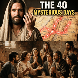
The period after the resurrection of Jesus Christ is described in the New Testament as a short but highly significant sequence of events. These accounts, primarily found in the Gospels and the Book of Acts, describe appearances, teachings, and final moments before his ascension. When placed on a map of the ancient world—especially in regions like Judea and Galilee—they form a geographic narrative that connects key locations in early Christianity.
1. The Empty Tomb — Jerusalem
The story begins in Jerusalem, where Jesus was reportedly buried and where the tomb was later found empty.
According to the Gospel accounts, several women followers discovered the empty tomb early in the morning. This location becomes the starting point of all post-resurrection narratives and remains central to Christian tradition.
2. First Appearances in Jerusalem
Still within Jerusalem, multiple accounts describe Jesus appearing to his followers. These include:
An appearance to Mary Magdalene
Appearances to the disciples gathered behind locked doors
A later appearance involving Thomas, who initially doubted
These events are said to have taken place within or near the city, marking Jerusalem as the first major hub of post-resurrection activity.
3. Road to Emmaus — Outside the City
One of the most detailed accounts describes two followers encountering Jesus on the road to Emmaus, a location believed to be west of Jerusalem.
Although the exact site of Emmaus is still debated, this story emphasizes movement from the city into surrounding countryside and highlights early spreading recognition among followers.
4. Galilee — The Northern Gathering Point
The narrative then shifts north to the region of Galilee.
According to the Gospels, Jesus instructed his disciples to meet him there. In this region, several key events are described:
Appearances by the Sea of Galilee
The reinstatement of Peter
Teachings delivered to groups of disciples
Galilee represents a return to the region where Jesus’ ministry originally began, creating a symbolic geographic loop in the narrative.
5. The Mountain in Galilee
One of the final gatherings is said to take place on a mountain in Galilee, where Jesus gives instructions to his followers. This includes what is often called the “Great Commission,” in which the disciples are told to spread teachings beyond their homeland.
The exact mountain is not named, which leaves its precise location open to interpretation, but it is consistently placed within the Galilean region.
6. The Ascension — Return to the Jerusalem Area
The final event occurs near Jerusalem, according to the traditional accounts. Jesus is described as leading his followers to a location near Bethany or the Mount of Olives, just outside the city.
This area, part of the greater Jerusalem landscape, is where the ascension is said to occur, marking the conclusion of the physical appearances in the narrative.
Mapping the Narrative
When plotted geographically, the post-resurrection events form a pattern:
-
Jerusalem — empty tomb and early appearances
Road to Emmaus — nearby rural region
Galilee — extended appearances and teachings
Return near Jerusalem — ascension
This movement between city and countryside reflects both historical geography and symbolic storytelling.
Historical and Academic Perspective
From the standpoint of biblical studies, these accounts are analyzed as theological narratives written by early communities rather than modern travel logs. Scholars examine how geography supports storytelling themes such as:
Movement from doubt to belief
Expansion from local to global mission
Connection between beginning and end of Jesus’ ministry
Conclusion
Mapping the post-resurrection accounts of Jesus Christ reveals a narrative deeply tied to real locations in ancient Judea and Galilee. Whether interpreted as historical events or religious tradition, the geographic structure plays an important role in how the story is understood and remembered.
Ultimately, the “map” is not just about places—it is about meaning, movement, and the way early followers understood the transformation they believed had taken place.
Continuing the geographic overview of post-resurrection accounts of Jesus Christ, later texts in the New Testament—especially the Book of Acts—extend the “map” far beyond Galilee and Jerusalem. The narrative shifts from isolated appearances to the rapid spread of early Christian communities across the eastern Mediterranean.
7. The Mount of Olives — Final Departure Point
Near Jerusalem, the Mount of Olives is described as the final location where Jesus is last seen by his disciples before the ascension.
This site, just east of the city, is significant in both geography and symbolism. It represents the boundary between the physical city and the wider world the disciples are instructed to reach.
8. Jerusalem as the Launch Center of the Movement
After the ascension, Jerusalem becomes the central hub of early activity:
Gathering of the disciples
Pentecost event described in Acts
Formation of the first Christian community
From the perspective of ancient history, Jerusalem functions as the administrative and religious starting point for the expansion of Christianity.
9. Samaria — The First Expansion Zone
The narrative then expands north into Samaria.
This region represents one of the earliest geographic expansions beyond strictly Jewish areas. The movement into Samaria reflects a shift from localized teaching to broader outreach.
10. Roadways of the Roman Empire
Early followers traveled along Roman roads connecting major cities. These routes enabled rapid movement of ideas and communities across the empire.
Key connected regions included:
Judea
Samaria
Syria
Asia Minor
This infrastructure is crucial in explaining how a small movement originating around Jerusalem could expand so quickly.
11. Damascus — A Turning Point Location
One of the most important cities in early Christian geography is Damascus.
It is associated with the conversion of Paul (originally Saul), who becomes a major figure in spreading Christianity beyond Judea. This event marks a major directional shift in the narrative—from internal community growth to external mission.
12. Antioch — First Major Multi-Ethnic Center
Another key location is Antioch, where followers of Jesus are first referred to as “Christians.”
Antioch becomes a strategic center for:
Mixed Jewish and Gentile communities
Missionary planning
Theological development
In historical studies, it is considered one of the earliest urban hubs of organized Christianity.
13. The Mediterranean Expansion Route
From Antioch and surrounding regions, the movement spreads across:
Asia Minor (modern Turkey)
Greece
Rome
These routes align with major trade and political centers of the Roman Empire, allowing rapid dissemination of teachings.
14. Rome — The Western Endpoint of the Early Narrative
Eventually, early Christian tradition places key figures in Rome.
While the New Testament does not describe Jesus traveling there after the resurrection, the city becomes central to the later development of Christianity, symbolizing the expansion from a local movement to an imperial presence.
15. Mapping Meaning, Not Just Geography
From an academic perspective in biblical studies, this “map” is not a literal travel log of post-resurrection events, but a narrative structure:
Jerusalem = origin and transformation
Galilee = continuity and teaching
Samaria = expansion boundary
Damascus/Antioch = global transition
Rome = culmination of spread
Each location serves both a geographic and symbolic function in the development of early Christianity.
Conclusion
When mapped together, the post-resurrection narratives of Jesus Christ trace a movement from a single city outward to the wider Mediterranean world. Whether viewed as historical reporting or theological storytelling, the geography reflects a clear progression: from local appearances to global expansion.
The result is not just a map of places—but a map of how ideas travel, evolve, and reshape entire civilizations.